What Is an Orthomosaic and What Is It Used For?

Are you wondering what an orthomosaic map is?
Drone surveying continues to rise, reaching about $58.4 billion by 2026. With this, industries using orthomosaic maps will increase.
Are you looking to take advantage of its benefits? Continue reading below for a lowdown on orthomosaic maps.
What is an Orthomosaic?
An orthomosaic is a collection of overlapping orthophotos. The process is about removing warps and twists. As a result, you’ll get a continuous map showing the subject.
“Ortho” means straight in Greek, while “mosaic” refers to colored glass or stone patterns. It means taking many orthophotos to make a big orthomosaic.
You can compare an orthomosaic with Google Earth. The main difference is that orthomosaic images are much sharper.
How Do You Make an Orthomosaic?
You can make an orthomosaic with a UAV or drone. It takes hundreds of photos of a subject from an aerial image perspective.
The user uploads these photos using photogrammetry software. It automates the “stitching” process.
After that, the software corrects the changes and twists. The process results in more consistent photographs.
Correcting the photos means getting straight images. The aerial view is like what you see in Google Earth.
Some drones have mapping software with orthomosaic capabilities. It allows the drone to make 2D orthomosaic images in real-time. Companies making orthomosaic maps for time-sensitive projects use them.
Orthomosaic vs. Normal Photos
What are the differences between orthomosaic and normal photos? It’s the perspective and accuracy of the images.
A photo has an aerial perspective. However, the surrounding side objects are visible. It all depends on the drone’s location during the shot.
Meanwhile, an orthophoto gives the same perspective view while applying geometric corrections. You can use orthomosaic maps to measure distances. It’s possible because of the image’s accuracy.
Different Uses of Orthomosaic Maps
Different industries rely on orthomosaic maps. The agricultural sector uses orthomosaic technology to track crop yields while preventing pests. Environmental groups rely on drone surveying to map plastic pollution.
Real estate companies need detailed maps to survey properties with accuracy. It allows them to capture accurate images for prospective investors.
First responders can also enjoy orthomosaic maps. ENTs and police use the images to track ongoing situations.
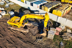
Construction firms use drones to get a better perspective of worksites. Meanwhile, orthomosaic maps help builders get real-time updates on their project’s progress. At the same time, they can track potential environmental challenges.
Trusted aerial inspection services can give quality aerial imaging and data collection.
Learn About Other Interesting Topics Now
Companies can get better images of lands, structures, and locations through orthomosaic techniques. They can get real-time images without compromising image quality and accuracy.
Starting with orthomosaic needs the correct expertise. If you want to master the discipline, consider some formal training.
Learn more about other technology by reading our different blog posts. We share topics for enriching your mind and more.
